The idea of running 20 miles was humbling enough the first time I ran it, but had I seen these pictures before then, I might have given up without trying.
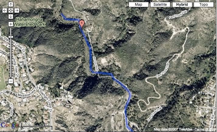

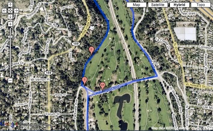
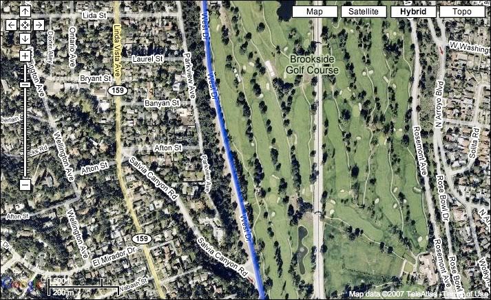
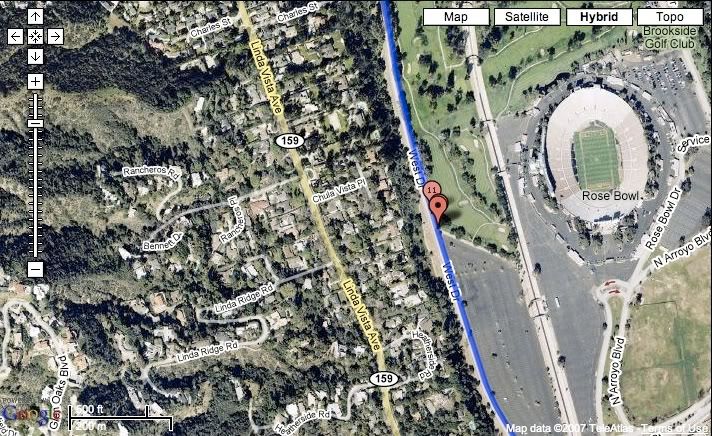


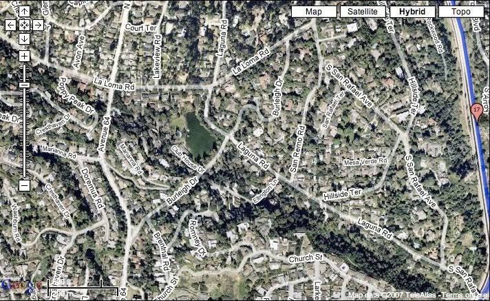
Our 20 (er, 19.3) mile course starts at the Lot K parking lot by the Rose Bowl (see photo #8). On Saturday I headed up north along West Dr. and when I got to Washington, I crossed it and ran the switchback on the west side of the golf course for a half mile, then turned right around and ran back to Washington on the north side of the Rose Bowl. I headed east on Washington and then turned left on Rosemont, up to the trails running along the east side of the golf course (the dead body I mentioned a couple of weeks back was found here). By the time I run underneath the 210 freeway I have completed over three miles.
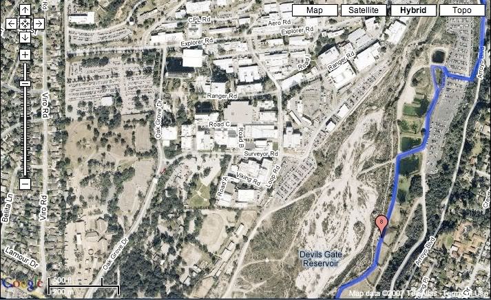
I decided to run the north side first because Devil's Gate Dam is one intimidating climb when you're at 100%, and so at the end of a long run you are likely to start rolling down it from exhaustion. At the top of Devil's Gate, I run through a short tunnel where a TNT aid station usually awaits.
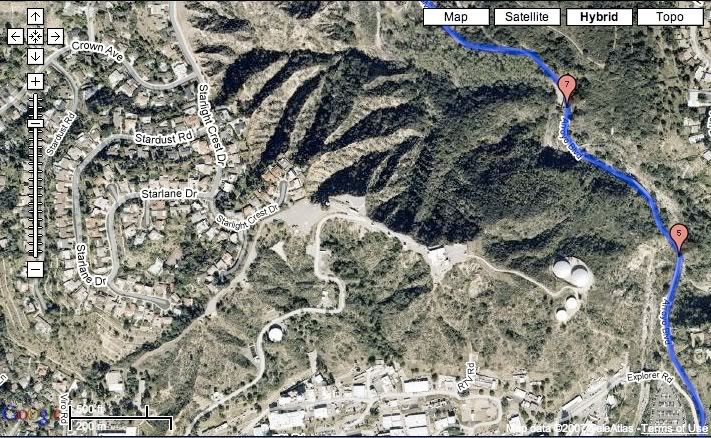
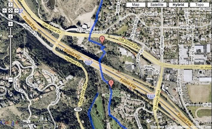
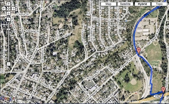
After replenishing some fluids and nibbling on pretzels and cookies, I head back to the trails and keep heading north, running along Oak Grove Park towards JPL. When I'm almost at JPL, I cross the JPL parking lot and run up another hill, which then puts me at Arroyo Blvd, and I then head towards Angeles Crest. This is a gradual climb for about a mile and a half. I keep running until I hit a sign reading "Elmer Smith Bridge," tap the sign and then retrace the trail I just ran. It's about five miles from the Elmer Smith Bridge back to the Lot K start line by the Rose Bowl, so by the time I get back there, I had run 11 miles. I take a brief break at my car to grab a new bottle of Gatorade and I head back out, this time running south.
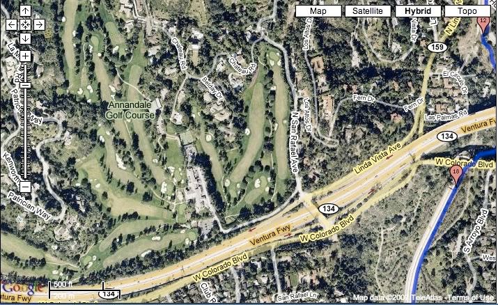
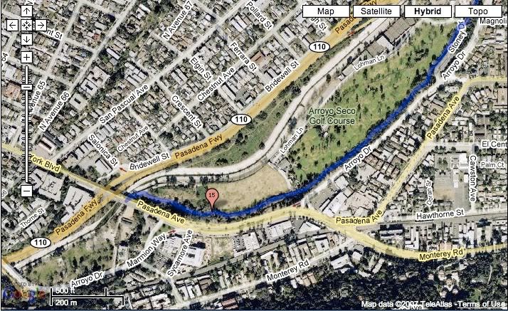
The southside trail is about 4 miles long and essentially we run along the arroyo towards South Pasadena. We run under yet another freeway (134), under the Colorado Street Bridge, and follow the path of the arroyo.
At San Pascual in South Pasadena, I depart the arroyo for a bit and run the perimeters of the baseball fields towards yet another tunnel and freeway (110). From there I ran along the southeast side of the Arroyo Seco Golf Course until it ends at the 110 freeway near the York Blvd. exit. I'm essentially near the border of South Pasadena and Highland Park. I tap one of the York Blvd. pillars and again retrace my steps back to where I started. At this point I have run about 15 miles and when I get back to the Rose Bowl I will have run over 19 miles.
Phew, it's exhausting just trying to explain it.
The run yesterday went well for the most part. I walked a couple of miles up to Elmer Smith Bridge with Alice, which I'm glad I did because it saved me some much needed energy for later. After I left Alice I was feeling great up until I hit the 14 mile mark. I started running out of gas here and wished I had another packet of Gu. Alas, I had no more and began feeling faint. I kept trudging ahead and took a couple of longer walk breaks.
Considering the walking I did early on and hitting the wall at the end of the run, my time was pretty respectable. I clocked in at 3:27, not my best long run, but also not my worst. Today, my legs feel fine, but I tweaked my right hip after three close calls at rolling my ankle during the run. Hopefully it will heal quickly. Apart from that, and the tightness near my right ankle, I'm in good shape.
So, there you go, if you're in Pasadena and would like to run 20 miles, just follow this handy map.

No comments:
Post a Comment